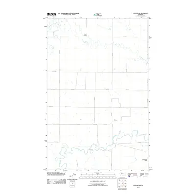
2011 Map of Collins NW
USGS Topo · Published 2011About this map
The Teton River snakes through the southern reaches of this Teton County landscape, carving a distinct path through the Montana plains. This area is defined by its drainage systems, where the river and Muddy Creek have shaped the local topography into a series of pronounced depressions including Kropp Coulee and Antelope Coulee. The map reveals a highly structured grid of section lines and rural thoroughfares, such as N Division and Division Ln, which speak to the late 20th and early 21st-century agricultural organization of the region. This layout highlights the systematic parceling of the high plains, where natural watercourses provide the only interruption to the geometric precision of the road network. Near the southeastern corner, Government Coulee marks another significant geological feature in an area otherwise dominated by open expanses and straight-line connectivity like Shining Mt Rd.
Find a feature on this map
24 named features on this map. Tap any name to fly to it.
Don’t see what you’re looking for? This feature index may not catch every label — zoom into the map to look around manually.
Map Details
Editions of this 2011 Collins NW Map
This is the sole edition of this map. No revisions or reprints were ever made.
Other maps of this area

1886 · Great Falls
USGS Topo · 1:250,000

1920 · Choteau
USGS Topo · 1:125,000

1920 · Dupuyer
USGS Topo · 1:125,000

1920 · Conrad
USGS Topo · 1:125,000

1938 · Gallup City
USGS Topo · 1:62,500

1942 · Gallup City
USGS Topo · 1:62,500

1950 · Collins
USGS Topo · 1:62,500

1954 · Great Falls
USGS Topo · 1:250,000

1954 · Shelby
USGS Topo · 1:250,000

1955 · Choteau
USGS Topo · 1:250,000