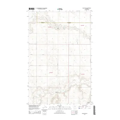
2014 Map of Collins NW
USGS Topo · Published 2014About this map
The Teton River flows across the southern reaches of this landscape, its path marked by significant elevation changes that form the Antelope Coulee and Government Coulee. This section of the High Plains, situated on the border of Pondera and Teton Counties, is defined by its rectilinear grid of section lines and gravel roads. In the north, Muddy Cr winds through the terrain near the Eyraud Lakes, while the central portion is incised by Kropp Coulee. The map illustrates a strictly managed agricultural and ranching environment, where the natural watercourses provide the only interruption to the systematic division of the land. Roadways like Shining Mountain Rd and a network of numbered routes such as 24th Rd NW provide access to this open country.
Find a feature on this map
26 named features on this map. Tap any name to fly to it.
Don’t see what you’re looking for? This feature index may not catch every label — zoom into the map to look around manually.
Map Details
Editions of this 2014 Collins NW Map
This is the sole edition of this map. No revisions or reprints were ever made.
Other maps of this area

1886 · Great Falls
USGS Topo · 1:250,000

1920 · Choteau
USGS Topo · 1:125,000

1920 · Dupuyer
USGS Topo · 1:125,000

1920 · Conrad
USGS Topo · 1:125,000

1938 · Gallup City
USGS Topo · 1:62,500

1942 · Gallup City
USGS Topo · 1:62,500

1950 · Collins
USGS Topo · 1:62,500

1954 · Great Falls
USGS Topo · 1:250,000

1954 · Shelby
USGS Topo · 1:250,000

1955 · Choteau
USGS Topo · 1:250,000