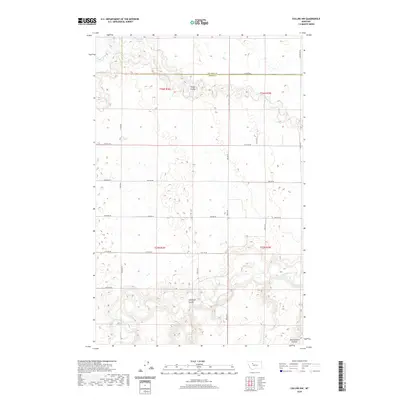
2020 Map of Collins NW
USGS Topo · Published 2020About this map
Teton Co and Pondera Co meet along a high plateau north of the Teton River, a landscape defined by dramatic drainage patterns and flat-topped benches. The northern portion of the sheet is marked by the winding course of Muddy Cr and the seasonally varying waters of the Eyraud Lakes. Deep erosional features like Kropp Coulee and Antelope Coulee slice through the plains, illustrating the topographical transition toward the river valley in the south. The area is gridded by a network of rural routes such as 26th Rd NE and Shining Mt Rd, reflecting the large-scale agricultural and ranching layout characteristic of north-central Montana. Near the southern border, Government Coulee marks the descent into the broader Teton River basin, providing a clear view of the land's natural drainage toward the east.
Find a feature on this map
28 named features on this map. Tap any name to fly to it.
Don’t see what you’re looking for? This feature index may not catch every label — zoom into the map to look around manually.
Map Details
Editions of this 2020 Collins NW Map
This is the sole edition of this map. No revisions or reprints were ever made.
Other maps of this area

1886 · Great Falls
USGS Topo · 1:250,000

1920 · Choteau
USGS Topo · 1:125,000

1920 · Dupuyer
USGS Topo · 1:125,000

1920 · Conrad
USGS Topo · 1:125,000

1938 · Gallup City
USGS Topo · 1:62,500

1942 · Gallup City
USGS Topo · 1:62,500

1950 · Collins
USGS Topo · 1:62,500

1954 · Great Falls
USGS Topo · 1:250,000

1954 · Shelby
USGS Topo · 1:250,000

1955 · Choteau
USGS Topo · 1:250,000