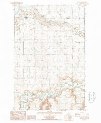
1987 Map of Collins NW
USGS Topo · Published 1987About this map
Teton River meanders across the southern portion of this landscape, its winding course defining the lower topography of the High Plains. To the north, Muddy Creek carves a complex drainage pattern, joined by the distinctive Kropp Coulee. The terrain is characterized by the broad, low-lying Alkali Flat, a feature typical of the region's semi-arid basin ecology. This 1987 provisional survey shows the transition across the Pondera and Teton County line, documenting the hydrology and landforms before modern agricultural or infrastructure changes significantly altered the drainage basins. The map provides a high-resolution look at the intricate contour intervals and water distribution in this sparsely settled Montana territory.
Find a feature on this map
5 named features on this map. Tap any name to fly to it.
Don’t see what you’re looking for? This feature index may not catch every label — zoom into the map to look around manually.
Map Details
Editions of this 1987 Collins NW Map
This is the sole edition of this map. No revisions or reprints were ever made.
Other maps of this area

1886 · Great Falls
USGS Topo · 1:250,000

1920 · Choteau
USGS Topo · 1:125,000

1920 · Dupuyer
USGS Topo · 1:125,000

1920 · Conrad
USGS Topo · 1:125,000

1938 · Gallup City
USGS Topo · 1:62,500

1942 · Gallup City
USGS Topo · 1:62,500

1950 · Collins
USGS Topo · 1:62,500

1954 · Great Falls
USGS Topo · 1:250,000

1954 · Shelby
USGS Topo · 1:250,000

1955 · Choteau
USGS Topo · 1:250,000