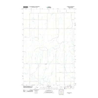
2011 Map of Collins SE
USGS Topo · Published 2011About this map
Beck Cemetery serves as a central landmark in this portion of Teton County, situated along 12th Rd NE. The landscape is defined by a rigid section-line grid typical of the Montana plains, where narrow local routes like Collins Rd and 9th Ln NE provide access to the agricultural interior. The presence of Rte 221 cutting through the northern section suggests a primary corridor for regional transit across this prairie environment. This survey captures the sparse, systematic distribution of rural infrastructure at the start of the 2010s, reflecting a landscape where movement is dictated by the cardinal directions of the road network. Genealogists and local historians can use the precise placement of the cemetery and the surrounding road labels to orient historical property records within this specific quadrant.
Find a feature on this map
15 named features on this map. Tap any name to fly to it.
Don’t see what you’re looking for? This feature index may not catch every label — zoom into the map to look around manually.
Map Details
Editions of this 2011 Collins SE Map
This is the sole edition of this map. No revisions or reprints were ever made.
Other maps of this area

1886 · Great Falls
USGS Topo · 1:250,000

1949 · Vaughn
USGS Topo · 1:62,500

1950 · Fairfield
USGS Topo · 1:62,500

1950 · Dutton
USGS Topo · 1:62,500

1950 · Collins
USGS Topo · 1:62,500

1952 · Vaughn
USGS Topo · 1:62,500

1954 · Great Falls
USGS Topo · 1:250,000

1957 · Great Falls
USGS Topo · 1:250,000

1976 · Great Falls North
USGS Topo · 1:100,000
1983 · Cleiv
USGS Topo · 1:24,000