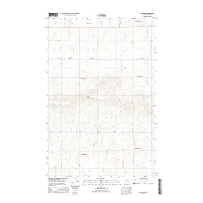
2017 Map of Collins SE
USGS Topo · Published 2017About this map
Teton Ridge dominates the central landscape of this Teton County survey, creating a significant topographic barrier between the northern plains and the southern drainages. The area is defined by its vast agricultural grid, where long thoroughfares like Choteau Rd and 18th Rd Ne facilitate transport across the high Montana terrain. Low-lying areas such as Trail Coulee provide the primary relief from the elevated plateau, offering a look at the natural drainage patterns of the region.
Find a feature on this map
16 named features on this map. Tap any name to fly to it.
Don’t see what you’re looking for? This feature index may not catch every label — zoom into the map to look around manually.
Map Details
Editions of this 2017 Collins SE Map
This is the sole edition of this map. No revisions or reprints were ever made.
Other maps of this area

1886 · Great Falls
USGS Topo · 1:250,000

1949 · Vaughn
USGS Topo · 1:62,500

1950 · Fairfield
USGS Topo · 1:62,500

1950 · Dutton
USGS Topo · 1:62,500

1950 · Collins
USGS Topo · 1:62,500

1952 · Vaughn
USGS Topo · 1:62,500

1954 · Great Falls
USGS Topo · 1:250,000

1957 · Great Falls
USGS Topo · 1:250,000

1976 · Great Falls North
USGS Topo · 1:100,000
1983 · Cleiv
USGS Topo · 1:24,000