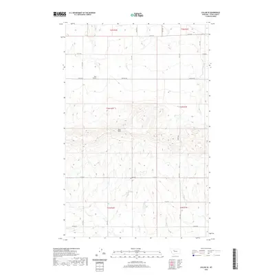
2020 Map of Collins SE
USGS Topo · Published 2020About this map
Teton Ridge dominates the central landscape of this Teton County survey, rising above the surrounding agricultural plains. The terrain is marked by the deep incision of Trail Coulee to the north, a significant drainage feature in an area defined by wide-open spaces and a systematic grid of section lines. This rural expanse is anchored by the Beck Cem, a quiet historical landmark located along 12th Rd NE. The map reveals a highly structured network of local roads, such as Choteau Rd and Collins Rd, which follow the township and range lines established by the Public Land Survey System. These roads connect isolated farmsteads and provide the primary infrastructure for this ranching and farming region, reflecting the long-standing land-use patterns of north-central Montana.
Find a feature on this map
23 named features on this map. Tap any name to fly to it.
Don’t see what you’re looking for? This feature index may not catch every label — zoom into the map to look around manually.
Map Details
Editions of this 2020 Collins SE Map
This is the sole edition of this map. No revisions or reprints were ever made.
Other maps of this area

1886 · Great Falls
USGS Topo · 1:250,000

1949 · Vaughn
USGS Topo · 1:62,500

1950 · Fairfield
USGS Topo · 1:62,500

1950 · Dutton
USGS Topo · 1:62,500

1950 · Collins
USGS Topo · 1:62,500

1952 · Vaughn
USGS Topo · 1:62,500

1954 · Great Falls
USGS Topo · 1:250,000

1957 · Great Falls
USGS Topo · 1:250,000

1976 · Great Falls North
USGS Topo · 1:100,000
1983 · Cleiv
USGS Topo · 1:24,000