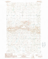
1987 Map of Collins SE
USGS Topo · Published 1987About this map
Teton Ridge dominates the center of this 1980s landscape in Teton County, where the high ground drops away into a complex network of seasonal drainages and depressions. The presence of Alkali and Alkali Flats across the terrain suggests a high-mineral, arid environment characteristic of this portion of Montana, where water is ephemeral and the soil composition dictates the land use. A lone Cem is marked in the central-southern portion of the sheet, providing a specific point of interest for genealogists and local historians tracing early inhabitants of the township. The map depicts a transitional landscape divided by the township lines of T 25 N, T 24 N, and T 23 N, showing the systematic grid of rural Montana as it appeared in the late twentieth century.
Find a feature on this map
6 named features on this map. Tap any name to fly to it.
Don’t see what you’re looking for? This feature index may not catch every label — zoom into the map to look around manually.
Map Details
Editions of this 1987 Collins SE Map
This is the sole edition of this map. No revisions or reprints were ever made.
Other maps of this area

1886 · Great Falls
USGS Topo · 1:250,000

1949 · Vaughn
USGS Topo · 1:62,500

1950 · Fairfield
USGS Topo · 1:62,500

1950 · Dutton
USGS Topo · 1:62,500

1950 · Collins
USGS Topo · 1:62,500

1952 · Vaughn
USGS Topo · 1:62,500

1954 · Great Falls
USGS Topo · 1:250,000

1957 · Great Falls
USGS Topo · 1:250,000

1976 · Great Falls North
USGS Topo · 1:100,000
1983 · Cleiv
USGS Topo · 1:24,000