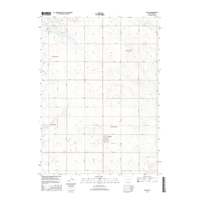
2015 Map of Collins
USGS Topo · Published 2015About this map
Collins sits at the center of this rural Story County landscape, where the Jefferson Highway and local routes like Main St and 315th St intersect. The township is defined by a dense network of watercourses, including Wolf Cr and Mud Cr, which drain the agricultural land surrounding the town. To the north, Hickory Grove Lake provides a significant water feature amidst the grid of sections and rural avenues. For genealogists and local historians, the map identifies key burial sites including Collins Cem just east of the main settlement and Mound Cem in the northwestern quadrant near Dye Cr. The terrain is characterized by subtle drainage basins for Willow Cr and Rock Cr, illustrating the relationship between the prairie hydrology and the modern road system that follows the Public Land Survey System boundaries.
Find a feature on this map
44 named features on this map. Tap any name to fly to it.
Don’t see what you’re looking for? This feature index may not catch every label — zoom into the map to look around manually.
Map Details
Editions of this 2015 Collins Map
This is the sole edition of this map. No revisions or reprints were ever made.
Other maps of this area

1954 · Waterloo
USGS Topo · 1:250,000

1954 · Des Moines
USGS Topo · 1:250,000

1955 · Waterloo
USGS Topo · 1:250,000

1956 · Des Moines
USGS Topo · 1:250,000

1957 · Des Moines
USGS Topo · 1:250,000

1969 · Des Moines
USGS Topo · 1:250,000
1972 · Loring
USGS Topo · 1:24,000

1975 · Nevada
USGS Topo · 1:24,000

1975 · Mingo
USGS Topo · 1:24,000

1975 · State Center
USGS Topo · 1:24,000