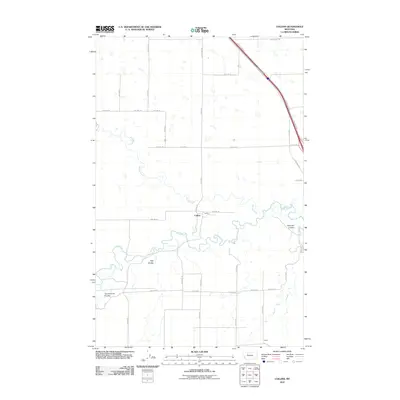
2011 Map of Collins
USGS Topo · Published 2011About this map
Collins and the smaller site of Acme anchor this Teton County landscape where the Teton River meets its tributary, Muddy Creek. The terrain is defined by its deep drainage patterns, most notably Railroad Coulee, Trail Coulee, and Government Coulee, which cut through the agricultural grid. Modern infrastructure is dominated by the corridor of I-15 and the Brady Frontage, while local travel relies on established routes like Collins Rd and S Brady Rd. The layout of the small settlement at Collins is visible near the river's bend, centered on Bridge St, providing a look at rural Montana's organized township and range system during the early 21st century.
Find a feature on this map
26 named features on this map. Tap any name to fly to it.
Don’t see what you’re looking for? This feature index may not catch every label — zoom into the map to look around manually.
Map Details
Editions of this 2011 Collins Map
This is the sole edition of this map. No revisions or reprints were ever made.
Other maps of this area

1886 · Great Falls
USGS Topo · 1:250,000

1920 · Conrad
USGS Topo · 1:125,000

1950 · Dutton
USGS Topo · 1:62,500

1950 · Collins
USGS Topo · 1:62,500

1954 · Great Falls
USGS Topo · 1:250,000

1954 · Shelby
USGS Topo · 1:250,000

1957 · Great Falls
USGS Topo · 1:250,000

1958 · Shelby
USGS Topo · 1:250,000

1967 · Brady
USGS Topo · 1:24,000

1967 · Fowler Coulee SW
USGS Topo · 1:24,000