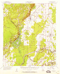
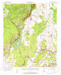
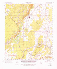
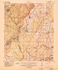
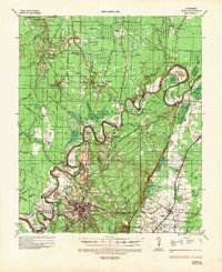
1957 Map of Collinston
USGS Topo · Published 1958About this map
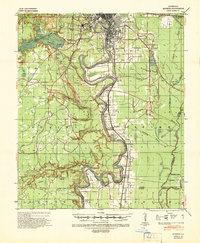
Bayou Bartholomew and the Boeuf River wind through this mid-century landscape of Morehouse Parish, defining a region where the alluvial bottomlands meet extensive gas fields. The Missouri Pacific Railroad serves as a primary transit spine, connecting the central hub of Collinston with smaller settlements like Windsor and Oak Ridge. This era shows a community structured around rural institutions, evidenced by the numerous named churches and cemeteries such as William Chapel, Salem Ch No 3, and Pine Grove Cem. Near the confluence of the bayous, significant archaeological history is noted by the presence of Indian Mounds. The western portion of the map is dominated by the Wham Brake and a large labeled Gas Field, with the Fairbanks Lookout Tower providing a high vantage point over the dense brakes and industrial infrastructure.
Find a feature on this map
75 named features on this map. Tap any name to fly to it.
Don’t see what you’re looking for? This feature index may not catch every label — zoom into the map to look around manually.
Map Details
Editions of this 1957 Collinston Map
3 editions found
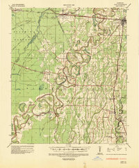
Other maps of this area
1935 · Collinston
USGS Topo · 1:62,500
1935 · Naff
USGS Topo · 1:62,500
1935 · Alto
USGS Topo · 1:62,500

1935 · Baskinton
USGS Topo · 1:62,500

1935 · Hurricane
USGS Topo · 1:62,500
1935 · Bonita
USGS Topo · 1:62,500

1935 · Drew
USGS Topo · 1:62,500
1935 · Haile
USGS Topo · 1:62,500
1940 · Monroe
USGS Topo · 1:62,500

1955 · Jackson
USGS Topo · 1:250,000