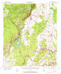
1957 Map of Collinston
USGS Topo · Published 1963About this map
The junction of the Missouri Pacific and Louisiana and Arkansas railroads at Collinston anchors this mid-century survey of the Mississippi Delta's western edge. The landscape is a complex network of wetlands and drainage controls, notably the sprawling Wham Brake and a system of levees and diversion canals that redirect Bayou Lafourche. This infrastructure illustrates the era's intensive water management designed to protect the surrounding agricultural fields and the small communities like Oak Ridge and Windsor.
Find a feature on this map
78 named features on this map. Tap any name to fly to it.
Don’t see what you’re looking for? This feature index may not catch every label — zoom into the map to look around manually.
Map Details
Editions of this 1957 Collinston Map
3 editions found

Other maps of this area

1935 · Collinston
USGS Topo · 1:62,500

1935 · Naff
USGS Topo · 1:62,500

1935 · Alto
USGS Topo · 1:62,500

1935 · Baskinton
USGS Topo · 1:62,500

1935 · Hurricane
USGS Topo · 1:62,500

1935 · Bonita
USGS Topo · 1:62,500

1935 · Drew
USGS Topo · 1:62,500

1935 · Haile
USGS Topo · 1:62,500

1940 · Monroe
USGS Topo · 1:62,500

1955 · Jackson
USGS Topo · 1:250,000