Old Maps of Ouachita Parish, Louisiana
Explore 135 old maps of Ouachita Parish, spanning from 1935 to today. These high-resolution historic maps reveal how streets, neighborhoods, landmarks, and natural features evolved over time — perfect for genealogy, metal detecting, research, and local history exploration.
What you can do with these maps:
- See how Ouachita Parish changed over time: Compare historical maps to modern-day views to trace roads, homesites, rail lines & more.
- View detailed metadata: Each map includes creators, publishers, year, scale, and archive source.
- Overlay maps with satellite & LiDAR: Visualize the past alongside modern tools to explore terrain & human change.
- Trusted historical sources: Maps sourced from the USGS, Library of Congress, and other archives.
- Access maps your way: View online, download high-res files, or order prints for personal or research use.
Start exploring old maps of Ouachita Parish to uncover forgotten places, hidden landmarks, and the deep history beneath your feet.
Ouachita Parish, LA maps
(135)- 1935 Map of Collinston
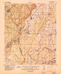 1935 Collinston1935 Print · USGSMorehouse and Ouachita Parishes are seen here in the mid-1930s during a period of heavy industrialization fueled by the natural gas boom. Researchers can trace the sprawling footprints of the Southern Carbon Co and find rural landmarks like Jerusalem Ch and the Indian Mounds.
 - 1935 Map of Alto, 1936 Print
 1935 Alto1936 Print · USGSRichland Parish in the mid-1930s shows a landscape of river-bottom agriculture and an early industrial energy boom. Researchers can trace the legacy of local river travel at Douciere Ferry and locate commercial sites like Rhymes Store or the Century Carbon Company.2 unique versions available
 - 1935 Map of Drew, 1947 Print
 1935 Drew1947 Print · USGSNorthern Louisiana's river country was defined by winding waterways and emerging energy infrastructure in the 1930s. Genealogists can trace early crossings like Whites Ferry and family-named locales such as Guthrie or the Childrens Home in Monroe.
 - 1940 Map of Monroe, 1942 Print
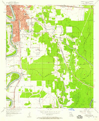
 1940 Monroe1942 Print · USGSThe Ouachita River valley at the onset of the 1940s shows a landscape defined by its waterways and burgeoning river towns. Genealogists and historians can trace family roots through numerous country landmarks like Logtown Ch, Faulks Sch, and the La Training Institute for Boys.2 unique versions available
 - 1952 Map of Calhoun, 1953 Print
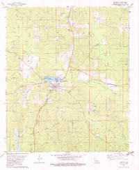
 1952 Calhoun1953 Print · USGSNorth Louisiana life in the early fifties centered on the rural crossroads and rail lines of Union and Ouachita Parishes. Genealogists can trace family footprints through numerous local landmarks like Millard Hill Cem, Auld Chapel, and the Experiment Station at Calhoun.3 unique versions available
 - 1953 Map of Chatham, 1954 Print
 1953 Chatham1954 Print · USGSLouisiana's piney hills and creek bottoms are meticulously detailed here in the early fifties, showing a network of rural parishes. Researchers can locate family landmarks like Mt Moriah Cem, the settlement of Indian Village, and the Old Railroad Grade.3 unique versions available
 - 1955 Map of Jackson
 1955 Jackson1955 Print · USGSThe Lower Mississippi Valley at the middle of the century reveals a landscape of deep river meanders and growing rail hubs. Genealogists and historians can trace the mid-century footprints of Vicksburg National Military Park, old river landings at Port Gibson, and the rail corridors of the Illinois Central Railroad.3 unique versions available
 - 1955 Map of Shreveport
 1955 Shreveport1955 Print · USGSNorthern Louisiana in the mid-fifties is captured here as a landscape of military bases, vast oil fields, and burgeoning college towns. Genealogists and historians can trace the rail-and-river economy through the Monroe Gas Field, Grambling College, and Barksdale Air Force Base.3 unique versions available
 - 1956 Map of Shreveport
 1956 Shreveport1956 Print · USGSNorthern Louisiana during the mid-fifties presents a complex landscape of booming oil fields and strategic military installations. Genealogists and historians can trace the infrastructure of the Monroe Gas Field and family-named locales from Cotton Valley to Jonesboro.
 - 1957 Map of Monroe North, 1958 Print
 1957 Monroe North1958 Print · USGSNorth of the city center in the late fifties, the riverfront and bayous define a landscape of growing neighborhoods and industrial sites. Researchers can trace family roots through landmarks like Bean Chapel, Neville High Sch, and the grounds of Selman Airport.2 unique versions available
 - 1957 Map of West Monroe North, 1958 Print
 1957 West Monroe North1958 Print · USGSWest Monroe and its northern rural reaches are captured here during a period of steady mid-century development. Researchers can trace ancestral footprints at Hasley Cem, locate rural landmarks like Goodhope Ch, or follow the Illinois Central rail line through the bayou country.4 unique versions available
 - 1957 Map of Mangham, 1958 Print
 1957 Mangham1958 Print · USGSRichland and Franklin Parishes in the late fifties reveal a landscape of river-bottom agriculture and small rail towns. Genealogists can trace family roots through numerous local landmarks like Rhymes High Sch, St Luke Cem, and Mt Zion Ch.3 unique versions available
 - 1957 Map of West Monroe South, 1958 Print
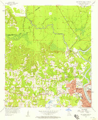
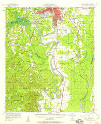
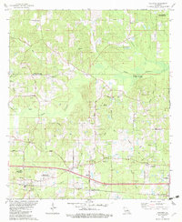
 1957 West Monroe South1958 Print · USGSOuachita Parish in the late fifties shows a landscape defined by the winding Ouachita River and the vast Cheniere Brake wetlands. Researchers can trace family sites at Old Sardis Cem or locate former landmarks like the Drive-in Theater and Woodlawn Sch.4 unique versions available
 - 1957 Map of Monroe South, 1958 Print
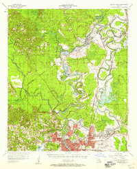
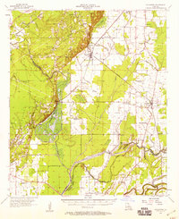
 1957 Monroe South1958 Print · USGSOuachita Parish at the peak of the 1950s reveals a bustling riverfront economy and expanding neighborhoods. Genealogists and local historians can trace the foundations of West Monroe and rural landmarks like Old St James Ch and Ballard Cem.5 unique versions available
 - 1957 Map of Monroe South, 1958 Print
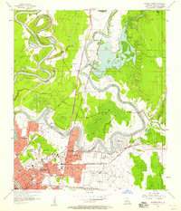
 1957 Monroe South1958 Print · USGSThe southern Ouachita Parish riverlands are captured here in the late fifties, showcasing a landscape of deep river bends and rural crossroads. Genealogists and researchers can locate ancestral sites like the Furlough Cemetery, Bawcomville, and the Union School along the Ouachita River banks.3 unique versions available
 - 1957 Map of Collinston, 1958 Print
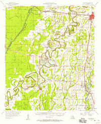
 1957 Collinston1958 Print · USGSMorehouse and Richland Parishes are shown in the late fifties, featuring the transition from agricultural bayous to active gas fields. Genealogists can locate family landmarks like Cedar Grove Sch, William Chapel, and the ancient Indian Mounds near Oak Ridge.3 unique versions available
 - 1957 Map of Monroe North, 1958 Print
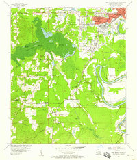
 1957 Monroe North1958 Print · USGSMonroe and the Ouachita River valley are captured in the late fifties as the city expanded northward toward the gas fields. Researchers can trace local history through NE Louisiana State College, Selman Airport, and family landmarks like Cosper Cem.4 unique versions available
 - 1961 Map of Jackson
 1961 Jackson1961 Print · USGSThe Lower Mississippi Delta and the state capital area are captured here during the post-war era of infrastructure expansion. Researchers can trace the complex river oxbows and rail lines connecting Vicksburg, Yazoo City, and the Illinois Central Railroad network.
 - 1962 Map of Jackson
 1962 Jackson1962 Print · USGSThe Mississippi Delta and the state capital region are mapped here in the early sixties, showing a landscape defined by the great river and the growing city of JACKSON. Genealogists can trace family roots through numerous landmarks like Cedar Hill Cem, rural stops on the Illinois Central RR, and historic sites like Champion Hill.2 unique versions available
 - 1969 Map of Monroe North
 1969 Monroe North1969 Print · USGSMonroe and West Monroe enter a period of rapid growth during the late sixties as urban development pushes into the surrounding bayous. Genealogists can trace family names and local sites from Northeast Louisiana State College to the quiet grounds of Memorial Park Cem and rural Ouachita City.
 - 1982 Map of Chatham
 1982 Chatham1982 Print · USGSJackson Parish in the early eighties centers on the industrial and rail hub of Chatham, where energy production and timber transport define the rural landscape. Genealogists can trace family names through several rural burial sites, including Brooklyn Ch Cem, Wyatt Cem, and Bethel Cem.
 - 1982 Map of Calhoun
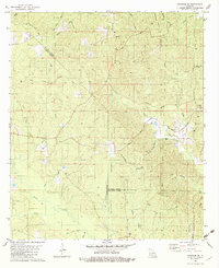
 1982 Calhoun1982 Print · USGSOuachita Parish in the early eighties shows a landscape of petroleum extraction and rural communities. Genealogists can trace family landmarks like Spillers Cem and Aulds Chapel, or explore the rail corridor of the Illinois Central Gulf.
 - 1982 Map of Chatham SE
 1982 Chatham SE1982 Print · USGSThe rural borderlands of Jackson, Ouachita, and Caldwell Parishes come into focus during the early eighties as a landscape of timber and rail. Researchers can trace family-named routes like Sam Brown Road and locate rural landmarks including Phantom Ch and Head Cem.
 - 1982 Map of Cadeville
 1982 Cadeville1982 Print · USGSOuachita Parish communities centered around local timber and gas extraction are captured here in the early eighties. Genealogists can trace family landmarks and rural life through Cadeville, the Wood Cem, and churches like Oak Grove Ch.
 - 1982 Map of Luna
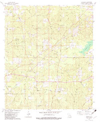
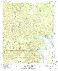 1982 Luna1982 Print · USGSThe river bottomlands of southern Ouachita Parish come alive in the early eighties as local industry and rural life intersect. Genealogists can trace family roots at St Pauls Cem or Furlow Cem, while mapping the development of the Vixen Gas Field and Fish Hatchery.
Showing maps 1-25 of 135
Top cities of Ouachita Parish
- Monroe historical maps
- West Monroe historical maps
- Claiborne historical maps
- Swartz historical maps
- Richwood historical maps
- Sterlington historical maps
Frequently asked questions
- What are the different types of historical maps available for Ouachita Parish?
- What is the oldest map of Ouachita Parish?
- Where can I purchase historical maps of Ouachita Parish for my home or office?
- Where can I download high-res historical maps of Ouachita Parish?
- Are there historical topographic maps available for Ouachita Parish?
- Is there historical aerial imagery available for Ouachita Parish?
- Where are historical maps of Ouachita Parish sourced from?