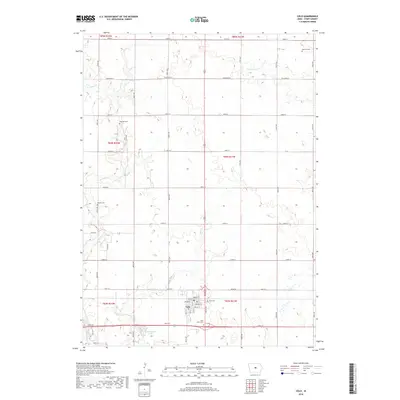
2018 Map of Colo
USGS Topo · Published 2018About this map
Colo sits at the southern edge of this central Iowa landscape, defined by a rigid grid of agricultural roads and a network of wandering waterways. The township structure is marked by several significant burial grounds, including Sparrow Cem in the northeast and Oak Hill Cem to the west, providing valuable points of reference for local family history. The hydrology of the region is dominated by the westward-flowing East Indian Creek and Dye Cr, which cut through the level terrain towards Twin Anchors Lake. Within the town of Colo, the street plan is clearly delineated, showing the alignment of Main St and Bailey St north of the primary thoroughfare, 240th St. This survey illustrates the persistent rural character of Story County, where small-town life and agricultural tradition intersect with the natural drainage basins of S Minerva Cr and Clear Cr.
Find a feature on this map
46 named features on this map. Tap any name to fly to it.
Don’t see what you’re looking for? This feature index may not catch every label — zoom into the map to look around manually.
Map Details
Editions of this 2018 Colo Map
This is the sole edition of this map. No revisions or reprints were ever made.
Other maps of this area

1954 · Waterloo
USGS Topo · 1:250,000

1954 · Des Moines
USGS Topo · 1:250,000

1955 · Waterloo
USGS Topo · 1:250,000

1956 · Des Moines
USGS Topo · 1:250,000

1957 · Des Moines
USGS Topo · 1:250,000

1969 · Des Moines
USGS Topo · 1:250,000

1975 · Nevada
USGS Topo · 1:24,000

1975 · State Center NW
USGS Topo · 1:24,000

1975 · State Center
USGS Topo · 1:24,000

1975 · Rhodes
USGS Topo · 1:24,000