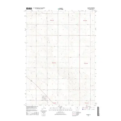
2015 Map of Colome
USGS Topo · Published 2015About this map
Colome serves as the primary hub of this Tripp County landscape, its grid layout defined by a series of named streets including Main St, Sullivan St, and Taft St. The town's southern edge is bounded by W 6th St, while Highway 31 provides a central north-south corridor through the surrounding sections. This 2015 survey illustrates a highly organized rural infrastructure, where an extensive network of numbered roads such as 280th St and 324th Ave partition the plains into a precise public land survey system. The drainage of W Bull Cr provides a subtle break in the geometric road pattern to the south, reflecting the agrarian character of the region. The detailed platting of the town site allows for a close examination of local property boundaries and the spatial relationship between the residential core and the outlying farmsteads.
Find a feature on this map
30 named features on this map. Tap any name to fly to it.
Don’t see what you’re looking for? This feature index may not catch every label — zoom into the map to look around manually.
Map Details
Editions of this 2015 Colome Map
This is the sole edition of this map. No revisions or reprints were ever made.
Other maps of this area

1955 · Mitchell
USGS Topo · 1:250,000

1959 · Mitchell
USGS Topo · 1:250,000

1964 · Dallas
USGS Topo · 1:24,000

1964 · Dallas NW
USGS Topo · 1:24,000

1971 · Colome
USGS Topo · 1:24,000

1971 · Rattlesnake Butte East
USGS Topo · 1:24,000

1971 · Rattlesnake Butte West
USGS Topo · 1:24,000

1971 · Colome SE
USGS Topo · 1:24,000

1982 · Winner North
USGS Topo · 1:25,000

1982 · Winner South
USGS Topo · 1:25,000