
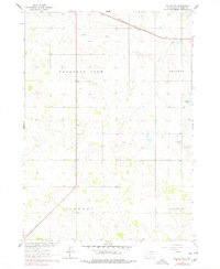
1964 Map of Dallas NW
USGS Topo · Published 1965About this map
The Chicago and North Western railroad corridor defines the northern landscape of this Tripp County region, following the subtle drainage of Ponca Creek. This mid-century survey illustrates the rural organization of South Dakota's prairie, where local identity is anchored by townships such as Pleasant View, Elliston, and Lincoln. These areas are dotted with essential community markers including Calvary Chapel and the Kansas Flat Sch, reflecting the distributed settlement pattern common to the Missouri River Basin development era.
Find a feature on this map
15 named features on this map. Tap any name to fly to it.
Don’t see what you’re looking for? This feature index may not catch every label — zoom into the map to look around manually.
Map Details
Editions of this 1964 Dallas NW Map
2 editions found
Other maps of this area

1955 · Mitchell
USGS Topo · 1:250,000

1959 · Mitchell
USGS Topo · 1:250,000

1964 · Dallas SW
USGS Topo · 1:24,000

1964 · Dallas
USGS Topo · 1:24,000

1964 · Paxton
USGS Topo · 1:24,000

1971 · Colome
USGS Topo · 1:24,000

1971 · Colome SE
USGS Topo · 1:24,000
1982 · Wewela
USGS Topo · 1:24,000

1982 · Winner South
USGS Topo · 1:25,000
1982 · Wewela NE
USGS Topo · 1:24,000