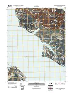
2011 Map of Colonial Beach North
USGS Topo · Published 2011About this map
The Potomac River dominates this coastal landscape where Maryland and Virginia meet, defining the development of settlements from Colonial Beach to the reaches of Mount Victoria. In the southern portion of the map, the grid of Classic Shore and the community surrounding the Colonial Beach Post Office show a concentrated waterfront layout. Across the water in Charles County, Maryland, the terrain transitions into the sprawling estates and points of Cobb Neck, including the Swan Point Golf Course and several distinctive coastal features like Bachelors Hope Point.
Find a feature on this map
114 named features on this map. Tap any name to fly to it.
Don’t see what you’re looking for? This feature index may not catch every label — zoom into the map to look around manually.
Map Details
Editions of this 2011 Colonial Beach North Map
This is the sole edition of this map. No revisions or reprints were ever made.
Other maps of this area

1889 · Fredericksburg
USGS Topo · 1:125,000

1892 · Fredericksburg
USGS Topo · 1:125,000

1892 · Montross
USGS Topo · 1:62,500

1894 · Wicomico
USGS Topo · 1:62,500

1894 · Fredericksburg
USGS Topo · 1:125,000

1895 · Wicomico
USGS Topo · 1:62,500

1895 · Nomini
USGS Topo · 1:125,000

1895 · Montross
USGS Topo · 1:62,500

1898 · Nomini
USGS Topo · 1:125,000

1902 · Wicomico
USGS Topo · 1:62,500