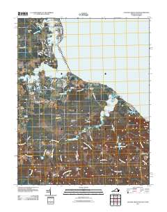
2011 Map of Colonial Beach South
USGS Topo · Published 2011About this map
Monroe Bay and the jagged southern shoreline of Potomac River define this corner of Westmoreland County, where numerous points and landings suggest a landscape deeply tied to the water. The northern reaches show a cluster of development around Monroe Hall and Springfield, while the interior transitions into a complex network of wetlands including The Big Swamp, Bundy Swamp, and Fox Hall Swamp.
Find a feature on this map
99 named features on this map. Tap any name to fly to it.
Don’t see what you’re looking for? This feature index may not catch every label — zoom into the map to look around manually.
Map Details
Editions of this 2011 Colonial Beach South Map
This is the sole edition of this map. No revisions or reprints were ever made.
Other maps of this area

1889 · Fredericksburg
USGS Topo · 1:125,000

1892 · Fredericksburg
USGS Topo · 1:125,000

1892 · Montross
USGS Topo · 1:62,500

1894 · Wicomico
USGS Topo · 1:62,500

1894 · Fredericksburg
USGS Topo · 1:125,000

1895 · Wicomico
USGS Topo · 1:62,500

1895 · Nomini
USGS Topo · 1:125,000

1895 · Montross
USGS Topo · 1:62,500

1898 · Nomini
USGS Topo · 1:125,000

1902 · Wicomico
USGS Topo · 1:62,500