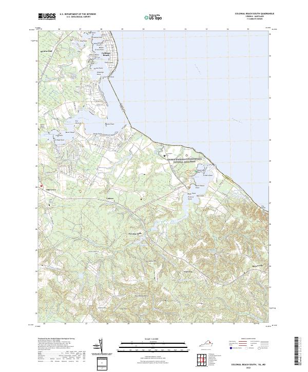
2022 Map of Colonial Beach South
USGS Topo · Published 2022About this map
George Washington Birthplace National Monument serves as the centerpiece of this Westmoreland County landscape, preserving the grounds where the first U.S. president was born along the banks of the Potomac River. The surrounding terrain is defined by a dense network of tidal creeks and marshes, including Popes Cr and Mattox Creek, which carve deep into the Virginia shoreline. These waterways historically shaped the settlement patterns seen here, from the established resort character of Colonial Beach at the northern edge to the agricultural and milling heritage found inland at Potomac Mills.
Find a feature on this map
142 named features on this map. Tap any name to fly to it.
Don’t see what you’re looking for? This feature index may not catch every label — zoom into the map to look around manually.
Map Details
Editions of this 2022 Colonial Beach South Map
This is the sole edition of this map. No revisions or reprints were ever made.
Other maps of this area

1889 · Fredericksburg
USGS Topo · 1:125,000

1892 · Fredericksburg
USGS Topo · 1:125,000

1892 · Montross
USGS Topo · 1:62,500

1894 · Wicomico
USGS Topo · 1:62,500

1894 · Fredericksburg
USGS Topo · 1:125,000

1895 · Wicomico
USGS Topo · 1:62,500

1895 · Nomini
USGS Topo · 1:125,000

1895 · Montross
USGS Topo · 1:62,500

1898 · Nomini
USGS Topo · 1:125,000

1902 · Wicomico
USGS Topo · 1:62,500