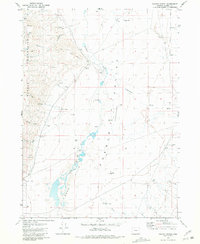
1981 Map of Colony Ranch
USGS Topo · Published 1984About this map
The Pueblo Mountains dominate the western edge of this High Desert landscape, giving way to the vast Pueblo Valley where water management defines human activity. In this arid reach of Harney County during the early 1980s, the eponymous Colony Ranch and the interestingly named Poor Farm indicate the sparse but significant settlement patterns of the region. The map reveals an intricate network of water resources, including the Pueblo Slough and various Flowing Wells, which were essential for sustaining life and livestock in the shadow of the Sand Hills. Numerous 4WD tracks crisscross the terrain, linking remote outposts like the Pueblo Well and sites of former activity marked by Ruins and a Corral. To the east, the landscape transitions through Mapes Flat toward Long Canyon, illustrating the topographical variation between the steep mountain slopes and the valley floor.
Find a feature on this map
30 named features on this map. Tap any name to fly to it.
Don’t see what you’re looking for? This feature index may not catch every label — zoom into the map to look around manually.
Map Details
Editions of this 1981 Colony Ranch Map
2 editions found
Other maps of this area

1886 · Disaster
USGS Topo · 1:250,000

1893 · Disaster
USGS Topo · 1:250,000

1954 · Vya
USGS Topo · 1:250,000

1955 · Adel
USGS Topo · 1:250,000

1957 · Adel
USGS Topo · 1:250,000

1958 · Vya
USGS Topo · 1:250,000

1958 · Adel
USGS Topo · 1:250,000

1961 · Trident Peak
USGS Topo · 1:62,500

1962 · Vya
USGS Topo · 1:250,000

1962 · Adel
USGS Topo · 1:250,000