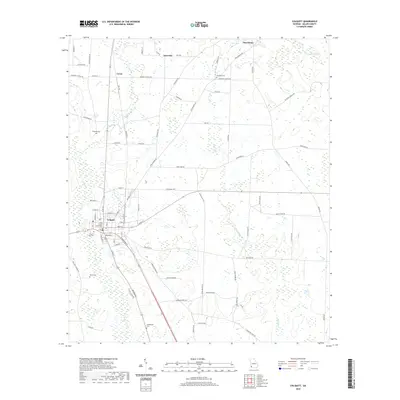
2020 Map of Colquitt
USGS Topo · Published 2020About this map
Colquitt serves as the focal point of this Miller County study, where the Miller County Courthouse stands at the center of a grid that defines the local government and commerce. The landscape is characterized by a high density of rural cemeteries and scattered settlements like Macedonia, Jeterville, and Corea, illustrating a long-established community structure. These nodes of activity are connected by an extensive network of named local roads such as Cooktown Rd and Harmony Church Rd, while a Rail Rd line cuts through the western portion of the territory near Corea.
Find a feature on this map
79 named features on this map. Tap any name to fly to it.
Don’t see what you’re looking for? This feature index may not catch every label — zoom into the map to look around manually.
Map Details
Editions of this 2020 Colquitt Map
This is the sole edition of this map. No revisions or reprints were ever made.
Other maps of this area

1953 · Dothan
USGS Topo · 1:250,000

1954 · Dothan
USGS Topo · 1:250,000

1955 · Dothan
USGS Topo · 1:250,000

1973 · Hentown
USGS Topo · 1:24,000

1974 · Boykin
USGS Topo · 1:24,000

1974 · Donalsonville NE
USGS Topo · 1:24,000

1974 · Damascus
USGS Topo · 1:24,000

1974 · Cooktown
USGS Topo · 1:24,000
1974 · Donalsonville East
USGS Topo · 1:24,000
1974 · Steinham Store
USGS Topo · 1:24,000