
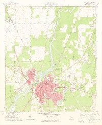
1974 Map of Boykin
USGS Topo · Published 1976About this map
Spring Creek and Aycocks Creek wind through the southwestern Georgia landscape, defining the rural character of this border region where Miller, Decatur, and Seminole counties meet. The mid-1970s settlement pattern is anchored by the Seaboard Coast Line railroad, which strings together the small communities of Boykin, Eldorendo, and Ausmac. The distribution of rural churches, including Mothers Home Ch, Morning Star Ch, and Shiloh Ch, suggests a deeply rooted community structure maintained even as transportation networks evolved. This survey preserves a specific moment before further agricultural consolidation, capturing fine details like fence and field lines alongside established landmarks such as the Hornsby Cem and the Gaging Station on the creek. The presence of a significant Pipeline cutting across the southern terrain marks the integration of industrial infrastructure into this traditionally agrarian environment.
Find a feature on this map
24 named features on this map. Tap any name to fly to it.
Don’t see what you’re looking for? This feature index may not catch every label — zoom into the map to look around manually.
Map Details
Editions of this 1974 Boykin Map
This is the sole edition of this map. No revisions or reprints were ever made.
Other maps of this area

1953 · Dothan
USGS Topo · 1:250,000

1954 · Dothan
USGS Topo · 1:250,000

1954 · Desser
USGS Topo · 1:24,000

1954 · Tallahassee
USGS Topo · 1:250,000

1955 · Dothan
USGS Topo · 1:250,000

1955 · Bainbridge
USGS Topo · 1:62,500

1959 · Tallahassee
USGS Topo · 1:250,000

1960 · Tallahassee
USGS Topo · 1:250,000

1974 · Donalsonville NE
USGS Topo · 1:24,000
1974 · Bainbridge
USGS Topo · 1:24,000