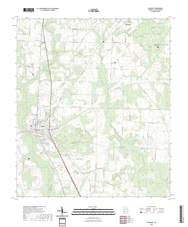
2024 Map of Colquitt
USGS Topo · Published 2024About this map
The city of Colquitt serves as the focal point of this Miller County landscape, anchored by the Miller County Courthouse and a grid of streets that transition into a network of rural routes. The surrounding agricultural and wooded terrain is marked by several small, historically significant settlements like Jeterville, Corea, and Macedonia. For family historians, the area is notably dense with burial grounds, ranging from the large Colquitt City Cem and Eternal Rest Memorial Gardens to smaller, family-named sites such as DeBarry Cem, Shepard Cem, and Swearingain Cem. Hydrological features like Spring Creek and Big Drain define the drainage of this coastal plain region, while Cow Pen Pond and Cecil Lake appear as distinct water bodies in the northern reaches. The Rail Rd corridor and local connectors such as Old Albany Rd and Cooktown Rd trace the movement of goods and people across this southwest Georgia community.
Find a feature on this map
87 named features on this map. Tap any name to fly to it.
Don’t see what you’re looking for? This feature index may not catch every label — zoom into the map to look around manually.
Map Details
Editions of this 2024 Colquitt Map
This is the sole edition of this map. No revisions or reprints were ever made.
Other maps of this area

1953 · Dothan
USGS Topo · 1:250,000

1954 · Dothan
USGS Topo · 1:250,000

1955 · Dothan
USGS Topo · 1:250,000

1973 · Hentown
USGS Topo · 1:24,000

1974 · Boykin
USGS Topo · 1:24,000

1974 · Donalsonville NE
USGS Topo · 1:24,000

1974 · Damascus
USGS Topo · 1:24,000

1974 · Cooktown
USGS Topo · 1:24,000
1974 · Donalsonville East
USGS Topo · 1:24,000
1974 · Steinham Store
USGS Topo · 1:24,000