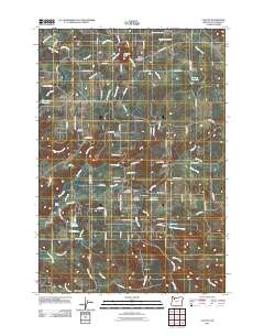
2011 Map of Colton
USGS Topo · Published 2011About this map
Colton and its predecessor, Old Colton, serve as the primary hubs in this corner of Clackamas County, situated at the confluence of Milk Creek and Canyon Creek. The settlement pattern reflects a deeply rooted rural community, where the Colton Post Office and Colton Lutheran Cemetery provide a central point for the surrounding homesteads and small agricultural plots. To the north, the landscape rises toward Highland Butte and the community of Upper Highland, while to the west, the smaller hamlet of Clarkes is identifiable by its own school and Clarkes Cemetery.
Find a feature on this map
97 named features on this map. Tap any name to fly to it.
Don’t see what you’re looking for? This feature index may not catch every label — zoom into the map to look around manually.
Map Details
Editions of this 2011 Colton Map
This is the sole edition of this map. No revisions or reprints were ever made.
Other maps of this area
1911 · Boring
USGS Topo · 1:48,000
1914 · Boring
USGS Topo · 1:62,500
1914 · Oregon City
USGS Topo · 1:62,500
1916 · Estacada
USGS Topo · 1:125,000
1939 · Molalla
USGS Topo · 1:62,500
1939 · Oregon City
USGS Topo · 1:62,500
1940 · Molalla
USGS Topo · 1:62,500
1940 · Boring
USGS Topo · 1:62,500
1941 · Oregon City
USGS Topo · 1:62,500

1948 · Vancouver
USGS Topo · 1:250,000