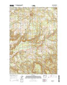
2014 Map of Colton
USGS Topo · Published 2014About this map
Colton and its neighboring communities in Clackamas County are defined by a complex network of creeks and small drainages that descend from high points like Highland Butte and Big Hill. This 2014 survey captures the rural character of the area, where clusters of settlement such as Old Colton, Clarkes, and Timber Grove are connected by narrow roads following the winding terrain. Water management is a visible priority on the landscape, seen in numerous catchments including Swanson Reservoir, Cedar Reservoir, and Karney Reservoir. Local history is anchored by several long-standing burial grounds, specifically Clarkes Cem, Bonney Cem, and Colton Lutheran Cem, which serve as key points of interest for genealogists. The topography is further punctuated by prominent landmarks such as Green Mtn, overlooking the various forks of Milk Cr and Bee Cr.
Find a feature on this map
133 named features on this map. Tap any name to fly to it.
Don’t see what you’re looking for? This feature index may not catch every label — zoom into the map to look around manually.
Map Details
Editions of this 2014 Colton Map
This is the sole edition of this map. No revisions or reprints were ever made.
Other maps of this area

1911 · Boring
USGS Topo · 1:48,000

1914 · Boring
USGS Topo · 1:62,500

1914 · Oregon City
USGS Topo · 1:62,500

1916 · Estacada
USGS Topo · 1:125,000

1939 · Molalla
USGS Topo · 1:62,500

1939 · Oregon City
USGS Topo · 1:62,500

1940 · Molalla
USGS Topo · 1:62,500

1940 · Boring
USGS Topo · 1:62,500

1941 · Oregon City
USGS Topo · 1:62,500

1948 · Vancouver
USGS Topo · 1:250,000