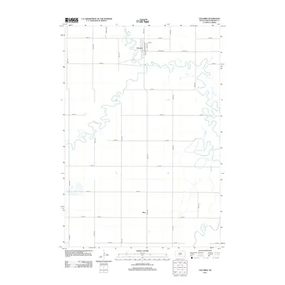
2012 Map of Columbia
USGS Topo · Published 2012About this map
The meandering James River and its tributary, the Elm River, define the landscape of Brown County in this 2012 survey. The town of Columbia serves as the primary settlement on this sheet, situated at the confluence of these waterways. Detailed street-level labels such as N Broadway St, Dakota Ave, and Stella St reveal the grid of the town center, where a local Po is also noted. Further south, the map identifies the small community of Plana, which sits along the intersection of 396th Ave and 129th St. The surrounding topography is dominated by a strict sectional road grid, including Roettele Rd and Larson Rd, which crisscross the expansive agricultural plains characteristic of this portion of South Dakota.
Find a feature on this map
27 named features on this map. Tap any name to fly to it.
Don’t see what you’re looking for? This feature index may not catch every label — zoom into the map to look around manually.
Map Details
Editions of this 2012 Columbia Map
This is the sole edition of this map. No revisions or reprints were ever made.
Other maps of this area

1894 · Columbia
USGS Topo · 1:62,500

1895 · Aberdeen
USGS Topo · 1:125,000

1896 · Columbia
USGS Topo · 1:125,000

1952 · Columbia
USGS Topo · 1:24,000

1952 · Ordway
USGS Topo · 1:24,000

1952 · Columbia NE
USGS Topo · 1:24,000

1952 · Westport
USGS Topo · 1:24,000

1952 · Putney
USGS Topo · 1:24,000

1954 · Bath
USGS Topo · 1:24,000

1954 · James
USGS Topo · 1:24,000