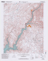
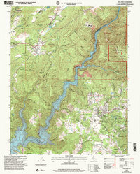
2001 Map of Columbia
USGS Topo · Published 2004About this map
Gold Rush history and contemporary recreation intersect where the Stanislaus River carves through the landscape of the Sierra Nevada foothills. This early 21st-century revision highlights the preserved architecture and streets of Columbia State Historic Park, surrounded by the legacy of hydraulic and hard-rock mining. Nearby settlements like Springfield, Shaws Flat, and the curiously named Squabbletown represent the dense habitation patterns established during the 19th-century mining boom.
Find a feature on this map
70 named features on this map. Tap any name to fly to it.
Don’t see what you’re looking for? This feature index may not catch every label — zoom into the map to look around manually.
Map Details
Editions of this 2001 Columbia Map
2 editions found
Other maps of this area

1889 · Jackson
USGS Topo · 1:125,000

1891 · Big Trees
USGS Topo · 1:125,000

1892 · Jackson
USGS Topo · 1:125,000

1893 · Sonora
USGS Topo · 1:125,000

1894 · Big Trees
USGS Topo · 1:125,000

1896 · Sonora
USGS Topo · 1:125,000

1897 · Jackson
USGS Topo · 1:125,000

1897 · Sonora
USGS Topo · 1:125,000

1897 · Big Trees
USGS Topo · 1:125,000

1898 · Sonora
USGS Topo · 1:125,000