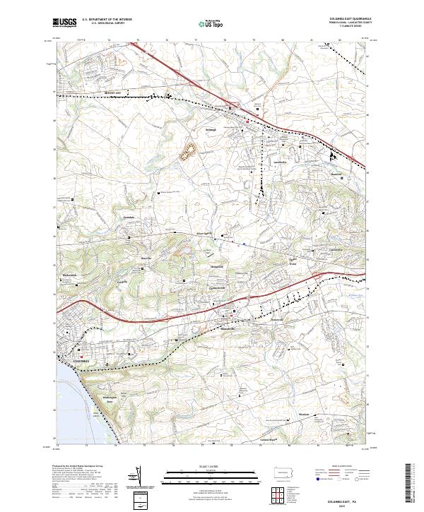
2023 Map of Columbia East
USGS Topo · Published 2023About this map
Lancaster County's agricultural and religious heritage is deeply etched into this landscape, where numerous family graveyards and denominational cemeteries anchor long-established communities. From the northern reaches of Mount Joy and Salunga down to the Susquehanna River, the map reveals a dense network of small settlements and named crossroads like Ironville, Kinderhook, and Oyster Point. The prevalence of sites such as the Salunga Mennonite Cem and Habecker Mennonite Cem reflects the area's strong Anabaptist roots and stable land-ownership patterns.
Find a feature on this map
65 named features on this map. Tap any name to fly to it.
Don’t see what you’re looking for? This feature index may not catch every label — zoom into the map to look around manually.
Map Details
Editions of this 2023 Columbia East Map
This is the sole edition of this map. No revisions or reprints were ever made.
Other maps of this area

1902 · Lancaster
USGS Topo · 1:62,500

1904 · Lancaster
USGS Topo · 1:62,500

1908 · Middletown
USGS Topo · 1:62,500

1908 · York
USGS Topo · 1:62,500

1910 · York
USGS Topo · 1:62,500

1912 · Mc Calls Ferry
USGS Topo · 1:62,500

1943 · Lancaster
USGS Topo · 1:62,500

1943 · Middletown
USGS Topo · 1:62,500

1943 · Mc Calls Ferry
USGS Topo · 1:62,500

1948 · Baltimore
USGS Topo · 1:250,000
Featured Places
- Mount Joy, PA
- Mountville, PA
- Mount Joy Township, PA
- East Donegal Township, PA
- East Hempfield Township, PA