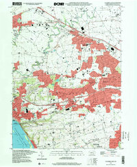
1997 Map of Columbia East
USGS Topo · Published 2000About this map
The Susquehanna River and its wide Lake Clarke reservoir define the southwestern corner of this Lancaster County landscape. The riverbank is dominated by the industrial and residential grid of Columbia, where Mt Bethel Ch and Columbia High Sch stand near the busy waterfront. Inland, the terrain rises into the prominent Chestnut Hill, a ridge that separates the river valley from a dense network of suburban and rural settlements. This era shows significant development between the established boroughs of Mount Joy and Mountville, with the landscape transitioning from active farmland to residential clusters like Salunga and Landisville.
Find a feature on this map
79 named features on this map. Tap any name to fly to it.
Don’t see what you’re looking for? This feature index may not catch every label — zoom into the map to look around manually.
Map Details
Editions of this 1997 Columbia East Map
This is the sole edition of this map. No revisions or reprints were ever made.
Other maps of this area

1902 · Lancaster
USGS Topo · 1:62,500

1904 · Lancaster
USGS Topo · 1:62,500

1908 · Middletown
USGS Topo · 1:62,500

1908 · York
USGS Topo · 1:62,500

1910 · York
USGS Topo · 1:62,500

1912 · Mc Calls Ferry
USGS Topo · 1:62,500

1943 · Lancaster
USGS Topo · 1:62,500

1943 · Middletown
USGS Topo · 1:62,500

1943 · Mc Calls Ferry
USGS Topo · 1:62,500

1948 · Baltimore
USGS Topo · 1:250,000