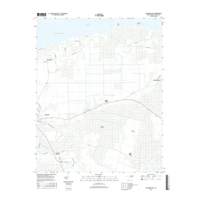
2016 Map of Columbia East
USGS Topo · Published 2016About this map
Albemarle Sound and the Atlantic Ocean define the northern limits of this coastal landscape, where the town of Columbia serves as a primary hub. The terrain is characterized by expansive wetlands and low-lying features such as Big Savanna and Cranberry Island, illustrating the intricate drainage patterns of Tyrrell County. Small communities like Soundside, Newfoundland, and Pleasant View are connected by a network of local roads and the prominent thoroughfare of Old US Hwy 64.
Find a feature on this map
40 named features on this map. Tap any name to fly to it.
Don’t see what you’re looking for? This feature index may not catch every label — zoom into the map to look around manually.
Map Details
Editions of this 2016 Columbia East Map
This is the sole edition of this map. No revisions or reprints were ever made.
Other maps of this area

1906 · Hertford
USGS Topo · 1:62,500

1940 · Hertford
USGS Topo · 1:62,500

1940 · Wade Point
USGS Topo · 1:62,500

1943 · Wade Point
USGS Topo · 1:62,500

1943 · Columbia
USGS Topo · 1:125,000

1948 · Wade Point
USGS Topo · 1:62,500

1953 · Norfolk
USGS Topo · 1:250,000

1953 · Columbia East
USGS Topo · 1:24,000

1953 · Scotia
USGS Topo · 1:24,000

1953 · Columbia West
USGS Topo · 1:24,000