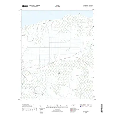
2019 Map of Columbia East
USGS Topo · Published 2019About this map
The coastal marshlands and alluvial plains of Tyrrell County meet the Albemarle Sound on this modern survey, revealing a landscape defined by drainage and reclamation. The settlement of Columbia occupies the western edge of the sheet, serving as the gateway to the intricate network of ridges and low-lying savannahs to the east. Broad tracts of wetlands, such as Big Savanna and the interior Cranberry Island, are bisected by long straight roads and agricultural ditches that characterize the region's topography. Long-standing local identifiers persist through family-named landmarks and routes, including Dillion Ridge and Mills Ridge, while the northern shoreline is punctuated by prominent features like Ship Point and Palmetto Point. Small rural communities such as Soundside, Newfoundland, and Pleasant View are linked by a grid of coastal roads, including the curiously named Pity My Shoe Rd and Pot Licker Rd, reflecting the deep-rooted local history of this tidewater region.
Find a feature on this map
39 named features on this map. Tap any name to fly to it.
Don’t see what you’re looking for? This feature index may not catch every label — zoom into the map to look around manually.
Map Details
Editions of this 2019 Columbia East Map
This is the sole edition of this map. No revisions or reprints were ever made.
Other maps of this area

1906 · Hertford
USGS Topo · 1:62,500

1940 · Hertford
USGS Topo · 1:62,500

1940 · Wade Point
USGS Topo · 1:62,500

1943 · Wade Point
USGS Topo · 1:62,500

1943 · Columbia
USGS Topo · 1:125,000

1948 · Wade Point
USGS Topo · 1:62,500

1953 · Norfolk
USGS Topo · 1:250,000

1953 · Columbia East
USGS Topo · 1:24,000

1953 · Scotia
USGS Topo · 1:24,000

1953 · Columbia West
USGS Topo · 1:24,000