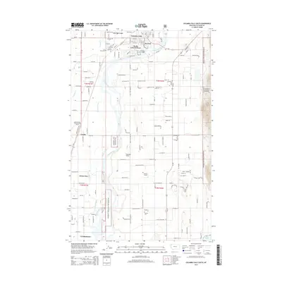
2014 Map of Columbia Falls South
USGS Topo · Published 2014About this map
The Flathead River snakes through the heart of the Flathead Valley, defining the geography of this Montana landscape in 2014. Just south of Columbia Falls, the river is spanned by the Flathead River Bridge near the residential area of Big Sky Colonial Manor. This region serves as a vital transportation and community hub, anchored by the Glacier Park International Airport in the west and the smaller Hoerner Airport to the east. Local history and genealogy are preserved in several distinct sites, including the Soldiers Home Cem and Woodlawn Cem. The map illustrates the transition from the developed streets of Evergreen and Helena Flats to the protected woodlands of the Flathead National Forest, which rises toward Boulder Ridge and overlooks the waters of Lake Blaine.
Find a feature on this map
142 named features on this map. Tap any name to fly to it.
Don’t see what you’re looking for? This feature index may not catch every label — zoom into the map to look around manually.
Map Details
Editions of this 2014 Columbia Falls South Map
This is the sole edition of this map. No revisions or reprints were ever made.
Other maps of this area

1943 · Kalispell
USGS Topo · 1:125,000

1957 · Kalispell
USGS Topo · 1:250,000

1960 · Kalispell
USGS Topo · 1:250,000

1961 · Kalispell
USGS Topo · 1:250,000

1962 · Columbia Falls South
USGS Topo · 1:24,000

1962 · Doris Mountain
USGS Topo · 1:24,000

1962 · Rose Crossing
USGS Topo · 1:24,000

1962 · Hungry Horse
USGS Topo · 1:24,000

1962 · Creston
USGS Topo · 1:24,000

1962 · Hash Mountain
USGS Topo · 1:24,000