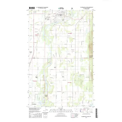
2017 Map of Columbia Falls South
USGS Topo · Published 2017About this map
The Flathead River dictates the landscape of this portion of the Flathead Valley, winding south from the city of Columbia Falls. This 2017 survey reveals the intricate water network of the region, where secondary channels like Goodrich Bayou and Morning Slough branch through the lowlands west of the Flathead National Forest boundary. The area's communal history is anchored by several prominent sites, including the Montana Veterans Home Cem and Saint Richard Cem, which sit near the residential expansion of the valley floor. Transportation and commerce are centered on the Glacier Park International Airport and the Flathead River Bridge, connecting the established settlements of Helena Flats and La Salle with the industrial and residential growth in Evergreen near the southern map border.
Find a feature on this map
133 named features on this map. Tap any name to fly to it.
Don’t see what you’re looking for? This feature index may not catch every label — zoom into the map to look around manually.
Map Details
Editions of this 2017 Columbia Falls South Map
This is the sole edition of this map. No revisions or reprints were ever made.
Other maps of this area

1943 · Kalispell
USGS Topo · 1:125,000

1957 · Kalispell
USGS Topo · 1:250,000

1960 · Kalispell
USGS Topo · 1:250,000

1961 · Kalispell
USGS Topo · 1:250,000

1962 · Columbia Falls South
USGS Topo · 1:24,000

1962 · Doris Mountain
USGS Topo · 1:24,000

1962 · Rose Crossing
USGS Topo · 1:24,000

1962 · Hungry Horse
USGS Topo · 1:24,000

1962 · Creston
USGS Topo · 1:24,000

1962 · Hash Mountain
USGS Topo · 1:24,000