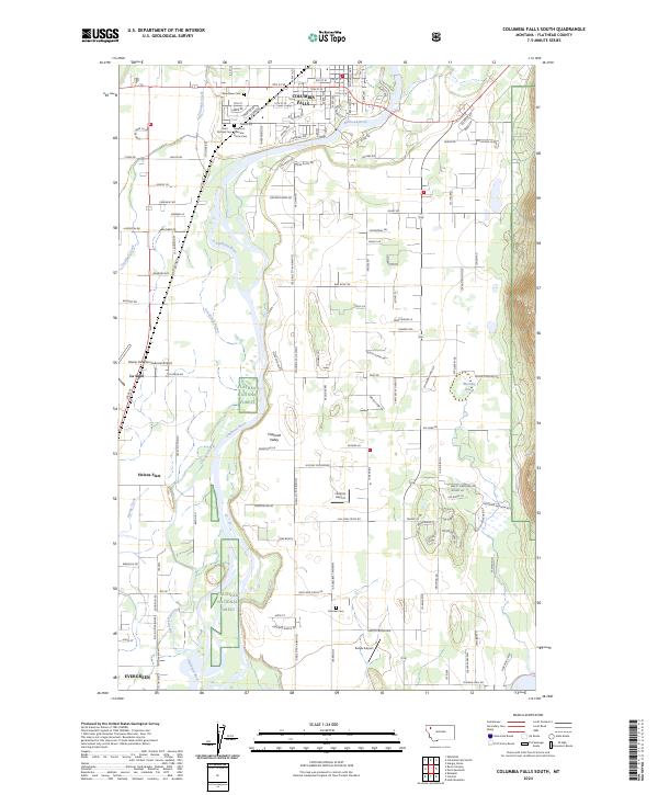
2024 Map of Columbia Falls South
USGS Topo · Published 2024About this map
The Flathead River carves a winding path through the Flathead Valley, anchoring the development and hydrology of this northern Montana region. In the northern reaches, Columbia Falls serves as a hub of activity, where several significant burial grounds are located, including Saint Richard Cem, Woodlawn Cem, and the Montana Veterans Home Cem. The landscape transitions from the residential and agricultural grid of Helena Flats and Evergreen to the protected wildlands of the Flathead National Forest along the eastern and western margins. Transportation and aviation define the central corridor, dominated by the Glacier Park International Airport and smaller airstrips like Hoener Airport and Sands Airport. Smaller waterways like Trumbull Creek and the meandering Gooderick Bayou highlight the complex drainage patterns of the valley floor.
Find a feature on this map
120 named features on this map. Tap any name to fly to it.
Don’t see what you’re looking for? This feature index may not catch every label — zoom into the map to look around manually.
Map Details
Editions of this 2024 Columbia Falls South Map
This is the sole edition of this map. No revisions or reprints were ever made.
Other maps of this area

1943 · Kalispell
USGS Topo · 1:125,000

1957 · Kalispell
USGS Topo · 1:250,000

1960 · Kalispell
USGS Topo · 1:250,000

1961 · Kalispell
USGS Topo · 1:250,000

1962 · Columbia Falls South
USGS Topo · 1:24,000

1962 · Doris Mountain
USGS Topo · 1:24,000

1962 · Rose Crossing
USGS Topo · 1:24,000

1962 · Hungry Horse
USGS Topo · 1:24,000

1962 · Creston
USGS Topo · 1:24,000

1962 · Hash Mountain
USGS Topo · 1:24,000