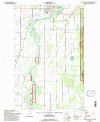
1994 Map of Columbia Falls South
USGS Topo · Published 1997About this map
Flathead River meanders south from Columbia Falls, defining the geography of this 1990s Montana survey. The landscape is a mix of agricultural plots and institutional sites, notably the Soldiers Home and several community hubs like La Salle Grange Hall and Sunrift Hall. For local historians and genealogists, the map preserves the exact locations of several burial grounds, including Woodlawn Cem, St Richards Cem, and Fairview Cem.
Find a feature on this map
28 named features on this map. Tap any name to fly to it.
Don’t see what you’re looking for? This feature index may not catch every label — zoom into the map to look around manually.
Map Details
Editions of this 1994 Columbia Falls South Map
This is the sole edition of this map. No revisions or reprints were ever made.
Other maps of this area

1943 · Kalispell
USGS Topo · 1:125,000

1957 · Kalispell
USGS Topo · 1:250,000

1960 · Kalispell
USGS Topo · 1:250,000

1961 · Kalispell
USGS Topo · 1:250,000

1962 · Columbia Falls South
USGS Topo · 1:24,000

1962 · Doris Mountain
USGS Topo · 1:24,000

1962 · Rose Crossing
USGS Topo · 1:24,000

1962 · Hungry Horse
USGS Topo · 1:24,000

1962 · Creston
USGS Topo · 1:24,000

1962 · Hash Mountain
USGS Topo · 1:24,000