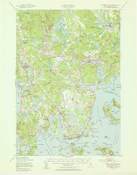
1941 Map of Columbia Falls
USGS Topo · Published 1955About this map
The Maine Central Railroad cuts a sharp horizontal line across this Down East landscape, serving the community at Jonesboro Sta and the village of Columbia Falls. This 1941 revision of early 20th-century surveys reveals a coastal economy defined by tidal rivers and sheltered harbors. The intricate coastline is dotted with numerous local schools serving isolated settlements, including the Monsapec Sch, Flyingplace Sch, and Cape Split Sch.
Find a feature on this map
131 named features on this map. Tap any name to fly to it.
Don’t see what you’re looking for? This feature index may not catch every label — zoom into the map to look around manually.
Map Details
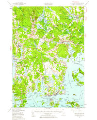
Editions of this 1941 Columbia Falls Map
3 editions found
Other maps of this area

1902 · Cherryfield
USGS Topo · 1:62,500

1904 · Cherryfield
USGS Topo · 1:62,500

1904 · Petit Manan
USGS Topo · 1:62,500

1918 · Machias
USGS Topo · 1:62,500

1921 · Great Wass Island
USGS Topo · 1:62,500

1921 · Columbia Falls
USGS Topo · 1:62,500

1921 · Columbia Falls
USGS Topo · 1:62,500

1941 · Columbia Falls
USGS Topo · 1:62,500

1941 · Machias
USGS Topo · 1:62,500

1941 · Wesley
USGS Topo · 1:62,500