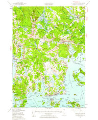
1941 Map of Columbia Falls
USGS Topo · Published 1961About this map
Columbia Falls and the surrounding Washington County coastline are defined by a complex network of tidal reaches and inland timberlands during the early 1940s. The Maine Central Railroad cuts across the northern interior, serving settlements like Whitneyville and providing a rail link at Jonesboro Station. The landscape is a mosaic of small farming and seafaring communities, from the inland heights of Centerville to the coastal fishing hubs of Jonesport and Beals.
Find a feature on this map
77 named features on this map. Tap any name to fly to it.
Don’t see what you’re looking for? This feature index may not catch every label — zoom into the map to look around manually.
Map Details
Editions of this 1941 Columbia Falls Map
3 editions found
Other maps of this area

1902 · Cherryfield
USGS Topo · 1:62,500

1904 · Cherryfield
USGS Topo · 1:62,500

1904 · Petit Manan
USGS Topo · 1:62,500

1918 · Machias
USGS Topo · 1:62,500

1921 · Great Wass Island
USGS Topo · 1:62,500

1921 · Columbia Falls
USGS Topo · 1:62,500

1921 · Columbia Falls
USGS Topo · 1:62,500

1941 · Columbia Falls
USGS Topo · 1:62,500

1941 · Machias
USGS Topo · 1:62,500

1941 · Wesley
USGS Topo · 1:62,500