
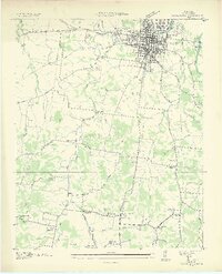
1936 Map of Columbia
USGS Topo · Published 1936About this map
Columbia serves as a dense municipal hub at the confluence of the Duck River and Riverside, where the local economy in the mid-1930s is defined by a convergence of major rail lines including the Louisville and Nashville Railroad and the Tennessee Central Railroad. Outside the city center, the landscape transitions into a specialized agricultural and institutional corridor, anchored by the State Agricultural Experiment Sta and the Columbia Mil Academy.
Find a feature on this map
51 named features on this map. Tap any name to fly to it.
Don’t see what you’re looking for? This feature index may not catch every label — zoom into the map to look around manually.
Map Details
Editions of this 1936 Columbia Map
2 editions found
Other maps of this area

1901 · Colombia
USGS Topo · 1:125,000

1936 · Godwin
USGS Topo · 1:24,000

1936 · Sandy Hook
USGS Topo · 1:24,000

1936 · Williamsport
USGS Topo · 1:24,000

1936 · Campbells Station
USGS Topo · 1:24,000

1936 · Carters Creek
USGS Topo · 1:24,000

1936 · Mount Pleasant
USGS Topo · 1:24,000

1936 · Glendale
USGS Topo · 1:24,000

1936 · Lynnville
USGS Topo · 1:24,000

1940 · Godwin
USGS Topo · 1:24,000