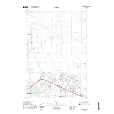
2020 Map of Columbia Point
USGS Topo · Published 2020About this map
The Columbia River and Lake Wallula dominate the southwestern corner of this quadrangle, defining the shoreline where Richland meets the water at Columbia Point. The landscape here is heavily shaped by water management, featuring a dense network of man-made waterways including the Esquatzel Diversion Channel, the Franklin County Irrigation Canal, and the Pasco Pump Lateral Canal. These systems support the agricultural and residential development spread between the urban centers of West Pasco and Pasco.
Find a feature on this map
88 named features on this map. Tap any name to fly to it.
Don’t see what you’re looking for? This feature index may not catch every label — zoom into the map to look around manually.
Map Details
Editions of this 2020 Columbia Point Map
This is the sole edition of this map. No revisions or reprints were ever made.
Other maps of this area

1917 · Pasco
USGS Topo · 1:125,000

1951 · Richland
USGS Topo · 1:62,500

1953 · Walla Walla
USGS Topo · 1:250,000

1958 · Walla Walla
USGS Topo · 1:250,000

1964 · Kennewick
USGS Topo · 1:24,000

1964 · Pasco
USGS Topo · 1:62,500
1964 · Pasco
USGS Topo · 1:24,000

1965 · Eltopia
USGS Topo · 1:62,500
1965 · Badger Mtn
USGS Topo · 1:24,000
1965 · Badger Mtn
USGS Topo · 1:62,500