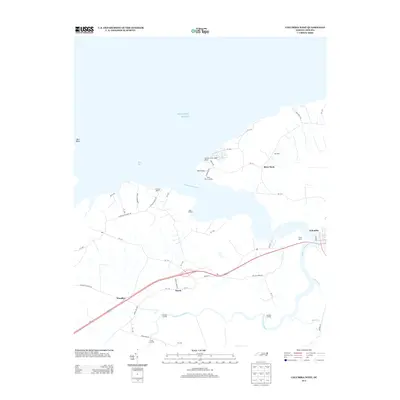
2013 Map of Columbia West
USGS Topo · Published 2013About this map
The Scuppernong River carves a winding path through the lowlands of Tyrrell County, defining the rural character of this coastal landscape. Near the river's mouth at Bull Bay, the small communities of River Neck and Norman Smith Legion Beach occupy the northern shore, while a series of historic river access points such as River Neck Landing, Back Landing, and Simmons Landing reflect a long-standing maritime orientation. Further inland, the settlement of Travis sits at the junction of Travis Rd and Travis School Rd, serving as a central point for the surrounding agricultural tracts. The western edge of the town of Columbia is visible, transitioning into the expansive Piney Marsh. This survey documents a transition between the open waters of the Atlantic Ocean and the intricate creek networks like Riders Cr and Second Cr.
Find a feature on this map
53 named features on this map. Tap any name to fly to it.
Don’t see what you’re looking for? This feature index may not catch every label — zoom into the map to look around manually.
Map Details
Editions of this 2013 Columbia West Map
This is the sole edition of this map. No revisions or reprints were ever made.
Other maps of this area

1906 · Hertford
USGS Topo · 1:62,500

1940 · Hertford
USGS Topo · 1:62,500

1940 · Wade Point
USGS Topo · 1:62,500

1943 · Wade Point
USGS Topo · 1:62,500

1943 · Columbia
USGS Topo · 1:125,000

1948 · Wade Point
USGS Topo · 1:62,500

1953 · Norfolk
USGS Topo · 1:250,000

1953 · Columbia East
USGS Topo · 1:24,000

1953 · Scotia
USGS Topo · 1:24,000

1953 · Columbia West
USGS Topo · 1:24,000