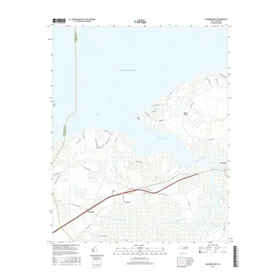
2016 Map of Columbia West
USGS Topo · Published 2016About this map
The Scuppernong River snakes through the heart of Tyrrell County, defining the rural character of this coastal landscape as it flows toward Bull Bay. Small inland settlements like Travis and Woodley are connected by a network of local roads such as Travis School Rd and Woodley Station Rd, illustrating the persistence of established community nodes in this wetland-heavy region. Near the river's mouth, Mill Point and the neighborhood of River Neck overlook the transition to the Atlantic Ocean.
Find a feature on this map
43 named features on this map. Tap any name to fly to it.
Don’t see what you’re looking for? This feature index may not catch every label — zoom into the map to look around manually.
Map Details
Editions of this 2016 Columbia West Map
This is the sole edition of this map. No revisions or reprints were ever made.
Other maps of this area

1906 · Hertford
USGS Topo · 1:62,500

1940 · Hertford
USGS Topo · 1:62,500

1940 · Wade Point
USGS Topo · 1:62,500

1943 · Wade Point
USGS Topo · 1:62,500

1943 · Columbia
USGS Topo · 1:125,000

1948 · Wade Point
USGS Topo · 1:62,500

1953 · Norfolk
USGS Topo · 1:250,000

1953 · Columbia East
USGS Topo · 1:24,000

1953 · Scotia
USGS Topo · 1:24,000

1953 · Columbia West
USGS Topo · 1:24,000