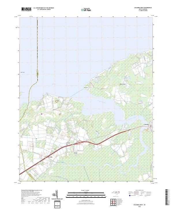
2022 Map of Columbia West
USGS Topo · Published 2022About this map
Bull Bay and the extensive wetlands of Big Swamp dominate this coastal landscape at the confluence of the Scuppernong River and the sound. The town of Columbia sits at the eastern edge of the sheet, where the river narrows and winds southward near Rider Creek. This modern survey illustrates the persistent importance of the river-and-road network in Tyrrell County, with smaller communities like Travis, Woodley, and River Neck linked by a web of local routes including Woodley Station Rd and Bay Post Office Rd. These settlements are situated on the slightly higher ground between the swampy interior and the riverbanks, where land use transitions from open water and marsh to established homesteads and local landmarks such as the Azalia Memorial Gardens Cem.
Find a feature on this map
41 named features on this map. Tap any name to fly to it.
Don’t see what you’re looking for? This feature index may not catch every label — zoom into the map to look around manually.
Map Details
Editions of this 2022 Columbia West Map
This is the sole edition of this map. No revisions or reprints were ever made.
Other maps of this area

1906 · Hertford
USGS Topo · 1:62,500

1940 · Hertford
USGS Topo · 1:62,500

1940 · Wade Point
USGS Topo · 1:62,500

1943 · Wade Point
USGS Topo · 1:62,500

1943 · Columbia
USGS Topo · 1:125,000

1948 · Wade Point
USGS Topo · 1:62,500

1953 · Norfolk
USGS Topo · 1:250,000

1953 · Columbia East
USGS Topo · 1:24,000

1953 · Scotia
USGS Topo · 1:24,000

1953 · Columbia West
USGS Topo · 1:24,000