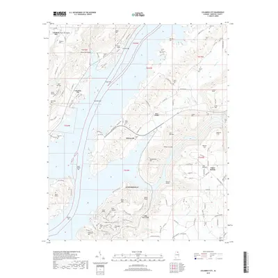
2018 Map of Columbus City
USGS Topo · Published 2018About this map
Guntersville Lake dominates the central landscape of this Marshall County quadrangle, where the Tennessee River's waters wrap around complex ridges and peninsulas. The settlement of Columbus City sits perched above the western banks, while Meltonsville and Five Points occupy the interior highlands to the east. This modern survey illustrates the rugged topography of Sand Mountain and numerous local summits like John Doss Mtn and Ellenburg Mtn.
Find a feature on this map
125 named features on this map. Tap any name to fly to it.
Don’t see what you’re looking for? This feature index may not catch every label — zoom into the map to look around manually.
Map Details
Editions of this 2018 Columbus City Map
This is the sole edition of this map. No revisions or reprints were ever made.
Other maps of this area

1885 · Gadsden
USGS Topo · 1:125,000

1888 · Gadsden
USGS Topo · 1:125,000

1888 · Scottsboro
USGS Topo · 1:125,000

1892 · Scottsboro
USGS Topo · 1:125,000

1892 · Gadsden
USGS Topo · 1:125,000

1895 · Gadsden
USGS Topo · 1:125,000

1903 · Gadsden
USGS Topo · 1:125,000

1936 · Painter
USGS Topo · 1:24,000

1936 · Guntersville
USGS Topo · 1:24,000

1936 · Columbus City
USGS Topo · 1:24,000