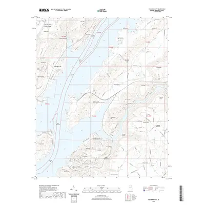
2020 Map of Columbus City
USGS Topo · Published 2020About this map
Guntersville Lake dominates this Marshall County landscape, where the Tennessee River's impoundment has created a complex shoreline of points and bars. The community of Columbus City sits on the western heights above the water, positioned near historic river features like Columbus Bar and Lower Bar. The topography is defined by significant ridges and hollows, including Gunters Mtn and Negro Mtn, which rise sharply from the water's edge.
Find a feature on this map
142 named features on this map. Tap any name to fly to it.
Don’t see what you’re looking for? This feature index may not catch every label — zoom into the map to look around manually.
Map Details
Editions of this 2020 Columbus City Map
This is the sole edition of this map. No revisions or reprints were ever made.
Other maps of this area

1885 · Gadsden
USGS Topo · 1:125,000

1888 · Gadsden
USGS Topo · 1:125,000

1888 · Scottsboro
USGS Topo · 1:125,000

1892 · Scottsboro
USGS Topo · 1:125,000

1892 · Gadsden
USGS Topo · 1:125,000

1895 · Gadsden
USGS Topo · 1:125,000

1903 · Gadsden
USGS Topo · 1:125,000

1936 · Painter
USGS Topo · 1:24,000

1936 · Guntersville
USGS Topo · 1:24,000

1936 · Columbus City
USGS Topo · 1:24,000