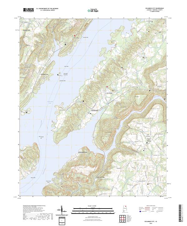
2024 Map of Columbus City
USGS Topo · Published 2024About this map
Guntersville Lake and the Tennessee River dominate this portion of Marshall County, shaping the landscape around the river-bend settlements of Columbus City and Meltonsville. The terrain is defined by a series of prominent ridges and mountains, including Gunters Mtn, Negro Mtn, and Ellenburg Mtn, which frame narrow valleys like Slater Hollow and Johnson Hollow. The historical importance of river crossings is evident through the presence of the Columbus City Ferry and the Town Creek Ferry, providing vital links between the banks where silt-heavy features like Buck Island Bar and Gunters Bar mark the shifting currents.
Find a feature on this map
139 named features on this map. Tap any name to fly to it.
Don’t see what you’re looking for? This feature index may not catch every label — zoom into the map to look around manually.
Map Details
Editions of this 2024 Columbus City Map
This is the sole edition of this map. No revisions or reprints were ever made.
Other maps of this area

1885 · Gadsden
USGS Topo · 1:125,000

1888 · Gadsden
USGS Topo · 1:125,000

1888 · Scottsboro
USGS Topo · 1:125,000

1892 · Scottsboro
USGS Topo · 1:125,000

1892 · Gadsden
USGS Topo · 1:125,000

1895 · Gadsden
USGS Topo · 1:125,000

1903 · Gadsden
USGS Topo · 1:125,000

1936 · Painter
USGS Topo · 1:24,000

1936 · Guntersville
USGS Topo · 1:24,000

1936 · Columbus City
USGS Topo · 1:24,000