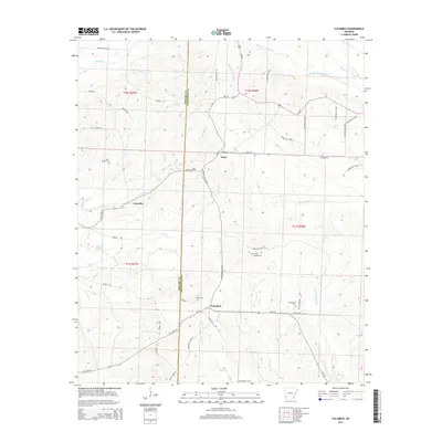
2014 Map of Columbus
USGS Topo · Published 2014About this map
Columbus serves as the central hub of this Hempstead County landscape, situated at the intersection of Ar 73 and Hempstead 13 RD. The terrain is defined by a dense network of tributaries including Sandy Bois d'Arc Cr, Plum Cr, and Yellow Cr, which shape the rural property lines and road layouts of the early 21st century. For genealogists, the map is particularly valuable for its documentation of local burial grounds, including the Mounds Cem near Columbus and the remote Section Sixteen Cem to the northeast. Small settlements such as Yancy and Schooley appear along the northern corridors, connected by a web of county roads like Stone RD and Liberty RD. The border between Howard Co and Hempstead Co runs vertically through the western portion of the sheet, providing a precise boundary for researchers tracking land records across county lines.
Find a feature on this map
56 named features on this map. Tap any name to fly to it.
Don’t see what you’re looking for? This feature index may not catch every label — zoom into the map to look around manually.
Map Details
Editions of this 2014 Columbus Map
This is the sole edition of this map. No revisions or reprints were ever made.
Other maps of this area

1950 · Red Bluff
USGS Topo · 1:24,000

1951 · Red Bluff
USGS Topo · 1:24,000

1951 · Mineral Springs South
USGS Topo · 1:24,000

1951 · Columbus
USGS Topo · 1:24,000

1951 · Sheppard
USGS Topo · 1:24,000

1951 · Mineral Springs North
USGS Topo · 1:24,000

1951 · Nashville
USGS Topo · 1:24,000

1951 · Washington
USGS Topo · 1:24,000

1951 · Mc Nab
USGS Topo · 1:24,000

1951 · McCaskill
USGS Topo · 1:24,000