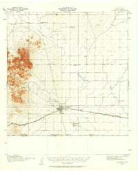
1917 Map of Columbus
USGS Topo · Published 1958About this map
Columbus serves as the focal point of this 1917 survey, situated just north of the United States Mexico international Boundary Line. The town is the primary hub of the region, positioned at the intersection of the El Paso and Southwestern railroad and the Deming Road. This period of borderlands history is marked by a landscape of isolated outposts and educational centers, including Mayfield School and Sunnyside School, alongside family-run operations like Stephenson Ranch and Rascon Ranch. To the west, the jagged peaks of the Tres Hermanas Mountains rise sharply above the desert floor, concealing sources such as Niggerhead Spring. The geography reflects a sparse, arid environment where water is a vital resource, evidenced by the presence of Deans Well, Stiles Reservoir, and the intermittent Arroyo Palomas. This map provides a look at the border region shortly after the 1916 raid on Columbus, showing the tactical layout of the town and its proximity to the Boundary Gate.
Find a feature on this map
21 named features on this map. Tap any name to fly to it.
Don’t see what you’re looking for? This feature index may not catch every label — zoom into the map to look around manually.
Map Details
Editions of this 1917 Columbus Map
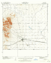
Other maps of this area

1899 · Deming
USGS Topo · 1:125,000

1915 · Deming
USGS Topo · 1:125,000

1917 · Hermanas
USGS Topo · 1:62,500

1917 · Camel Mountain
USGS Topo · 1:62,500

1917 · Columbus
USGS Topo · 1:62,500

1918 · Columbus
USGS Topo · 1:62,500

1918 · Hermanas
USGS Topo · 1:62,500

1920 · Columbus
USGS Topo · 1:62,500

1943 · Hermanas
USGS Topo · 1:62,500

1953 · El Paso
USGS Topo · 1:250,000