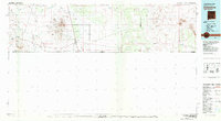
1981 Map of Columbus
USGS Topo · Published 1981About this map
The international border between United States and Mexico anchors this map, which documents the arid high-desert landscape of Luna and Doña Ana counties during the early 1980s. Centered on Columbus, the map details a region defined by its history of border conflict and mineral extraction, most notably preserved at Pancho Villa State Park. The terrain is dominated by isolated volcanic ranges and peaks, including the Tres Hermanas Mountains and West Potrillo Mountains, while a network of drainage features like Suckerville Draw and Seventysix Draw illustrate the local topography.
Find a feature on this map
48 named features on this map. Tap any name to fly to it.
Don’t see what you’re looking for? This feature index may not catch every label — zoom into the map to look around manually.
Map Details
Editions of this 1981 Columbus Map
This is the sole edition of this map. No revisions or reprints were ever made.
Other maps of this area

1891 · Las Cruces
USGS Topo · 1:125,000

1893 · Las Cruces
USGS Topo · 1:125,000

1899 · Deming
USGS Topo · 1:125,000

1915 · Deming
USGS Topo · 1:125,000

1917 · Hermanas
USGS Topo · 1:62,500

1917 · Camel Mountain
USGS Topo · 1:62,500

1917 · Columbus
USGS Topo · 1:62,500

1917 · Noria
USGS Topo · 1:62,500

1917 · Mt. Riley
USGS Topo · 1:62,500

1918 · Mt. Riley
USGS Topo · 1:62,500