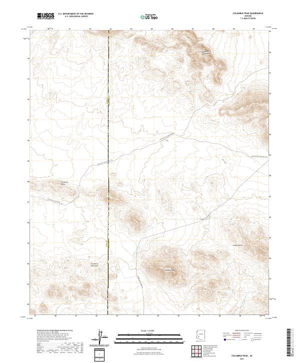
2021 Map of Columbus Peak
USGS Topo · Published 2021About this map
Columbus Peak and the surrounding desert landscape define this segment of the Arizona backcountry near the border of Yuma and Maricopa counties. The terrain is structured by the jagged reaches of the Eagletail Mountains to the north and the Gila Bend Mountains to the south, with the expansive Copper Valley lying between them. This 2021 survey reveals a remote environment where infrastructure is limited to essential desert routes like Arlington-Clanton Well Rd and S Harquahala Hyder Rd, which navigate the arid flats and skirt prominent landmarks such as Cemetery Ridge. Drainage patterns are clearly marked by ephemeral waterways like Columbus Wash and Copper Wash, providing essential topographical context for understanding the natural movement of water through this high-relief basin-and-range geography.
Find a feature on this map
14 named features on this map. Tap any name to fly to it.
Don’t see what you’re looking for? This feature index may not catch every label — zoom into the map to look around manually.
Map Details
Editions of this 2021 Columbus Peak Map
This is the sole edition of this map. No revisions or reprints were ever made.
Other maps of this area

1927 · Hyder
USGS Topo · 1:62,500

1930 · Hyder
USGS Topo · 1:62,500

1942 · Vicksburg
USGS Topo · 1:250,000

1951 · Dendora Valley
USGS Topo · 1:62,500

1954 · Phoenix
USGS Topo · 1:250,000

1957 · Phoenix
USGS Topo · 1:250,000

1958 · Phoenix
USGS Topo · 1:250,000

1960 · Phoenix
USGS Topo · 1:250,000

1962 · Cortez Peak
USGS Topo · 1:62,500

1962 · Eagletail Mts
USGS Topo · 1:62,500