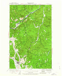
1929 Map of Colville
USGS Topo · Published 1963About this map
Colville and the surrounding river valleys are revealed in a period of intense extraction and early settlement, surveyed by S.N. Stoner and W.G. Carson in the late 1920s. The landscape is defined by the Columbia River and its tributaries, where the Great Northern Railway follows the water's edge to serve the region's mining and timber interests. The map documents a dense network of rural infrastructure, from the Old Fort Colville site to numerous remote educational outposts like Hansen Sch and Crystal Falls Sch.
Find a feature on this map
103 named features on this map. Tap any name to fly to it.
Don’t see what you’re looking for? This feature index may not catch every label — zoom into the map to look around manually.
Map Details
Editions of this 1929 Colville Map
2 editions found
Other maps of this area

1927 · Chewelah
USGS Topo · 1:125,000

1929 · Colville
USGS Topo · 1:125,000

1930 · Chewelah
USGS Topo · 1:125,000

1933 · Colville
USGS Topo · 1:125,000

1934 · Metaline
USGS Topo · 1:125,000

1936 · Marcus
USGS Topo · 1:96,000

1936 · Newport
USGS Topo · 1:96,000

1942 · Marcus
USGS Topo · 1:125,000

1942 · Metaline
USGS Topo · 1:125,000

1942 · Newport
USGS Topo · 1:125,000